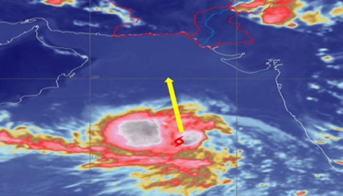
- Biparjoy currently does not pose any threat to Pakistan.
- Storm likely to move in north or northwest direction.
- CMO says most of Arabian Sea cyclones turn towards Oman or India.
The tropical cyclone Biparjoy present in the Arabian Sea is likely to intensify and transform into a Severe Cyclonic Storm (SCS) during the next 24 hours "due to favourable environmental conditions", the Pakistan Meteorological Department has said.
An updated alert on the situation of the cyclone issued by the Met department on Monday evening stated that the current location of the "cyclonic storm" in the southeast Arabian Sea is 1,420 kilometres south of Karachi, and it will continue to move in the north or northwest direction.
"[...} now lies near Latitude 12.3°N & Longitude 66.0°E about 1420km south of Karachi. Maximum sustained surface winds are 60-70 Km/hour gust 80 Km/hour around the system center," it added.
However, none of the coastal areas in the country are under threat of the cyclone. The PMD stated that its cyclone warning centre in Karachi is continuously monitoring the system and will keep issuing updates accordingly.
Moreover, all the concerned authorities are particularly advised to stay alert during the forecast period.
Biparjoy, which means "disaster or calamity", is a name suggested by Bangladesh for the tropical cyclone.
Sindh's Chief Meteorological Officer (CMO) Sardar Sarfaraz said that most of the cyclones in the Arabian Sea turn towards Oman or Indian Gujarat due to upper-level divergence, but an accurate prediction could be made once the cyclone moves 20 degrees north, The News reported.
He added that the movement of Biparjouy is being closely monitored.
Meanwhile, the Indian meteorological department suggested that the cyclonic storm will intensify into an SCS by Thursday morning and a very severe cyclonic storm by Friday evening.


0 Comments